Getting There - Aneel's Travelogue
< Previous: South of the border | Getting There - Aneel's Travelogue | Next: Oasis >
| To Cataviña | Cataviña, Baja California, Mexico, Tuesday, 30 June 2009 9:54pm |
|
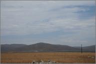
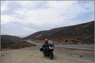
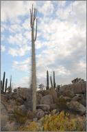
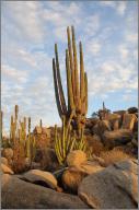
We didn't really get on the road until 11, what with getting breakfast and stopping to buy water and the miscellany that we figured we might need to pick up while we're still in a city (a power strip, some duct tape). We'd ridden part of the road south yesterday, on our way to La Bufadora, but that didn't stop us from getting lost on our way to it this morning. Quite soon after the turnoff for La Bufadora, we ran into more construction. This time was much worse. They were rebuilding the entire roadway, rather than just one lane at a time, like we'd seen before, so we rode for several kilometers on dirt. The road gets enough traffic that it was pretty well packed, but it was still rough, bumpy, slow going. Eventually we caught up to a bus, which was nice because the pickups that had been passing us realized that they couldn't get past the bus, and chilled out. About the point where we were wondering if the whole rest of the journey was going to happen at a crawl, the construction ended, and we were on our way again. The road was good or great for the rest of today's trip. Our unrealistic plan was to try to get to Guerrero Negro tonight, but by lunchtime it was clear that that was just impossible, so we set our sights on El Rosario, with the possibility of continuing on, depending on when we got there and how we felt. We passed through a variety of terrain: hot inland valleys (often filled with wine grapes, but in one case set up for cactus farming), barren high plains with just brown grass between the rocks, burnt scrublands, and gray coastal flats with sand and dune plants for miles. In town, there was a constant blanket of diesel fumes, but out in the open we passed by valleys full of fragrant desert plants in bloom. There was a succession of small towns along the side of the highway (the only paved road in the area). We pulled off onto sand, dirt, or gravel several times for gas and to stretch our legs, but it was hard to keep track of which settlement we were in. We had a late lunch in one town, a delicious roasted chicken, which may be the best food we've had so far. The restaurant owner told us we were in Camalú, about halfway to our destination. The ride sped up a bit as traffic thinned out further from Ensenada. By the time we got to the last military checkpoint before El Rosario, there were few enough cars for the soldiers to ask us where we were going, and where we'd come from, instead of just waving us through. In El Rosario we filled up on gas and stopped at Mama Espinoza's, which was the first checkpoint for the first Baja 1000 off-road rally in 1967. It's too on-road to be a checkpoint now, but the interior is still plastered with photos from all of the rally racers who've ever stopped by. We decided to continue on to Cataviña, in the hopes of getting the inland parts of the trip done during the (relative) cool of the early evening and tomorrow morning. We passed the "Gas 314km" sign without slowing down. We were worried that the road would be slow or congested, but it turned out to be awesome. Sweeping curves, almost no traffic, and weird scenery. Almost as soon as we left El Rosario, we started seeing Cirio trees, which look like alien plants: single straight tapering stalks with spikes. Occasionally they'd have a few branches which would also point almost straight up. Some of them seemed to be in bloom, with fans of small shoots with flowers at the tips. There were also enormous cacti. I don't think I've ever seen their like, even in Saguaro National Park. There's not much in Cataviña besides scenery, but the hotel that is here (apparently built by the government in the 70s) is pretty nice. I had a walk around and took pictures (the sun obliged by shining through a break in the clouds that dominated the western sky), and then had a swim in the pool. There are friendly dogs (some of which seem to belong to the Federales) who come up and demand to be petted as we sit on the porch where there is slow WiFi. No uploading pictures tonight... GPS Track: Day 4 233 mi |
|
